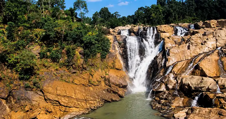
Why are there old hills, cut up valleys, and waterfalls in this region? Why is the area also known for key mineral deposits in eastern India. The answer is not only on the ground. It starts below it. The Chotanagpur Plateau is more than a raised landform. It reflects a long geological story. Deep old rock layers sit under it. Tectonic forces shaped the crust. Metamorphic changes altered the rocks over time. After that, erosion worked for a very long period. Bit by bit, the landforms were worn down and reshaped, leading to the valleys and falls we see today.
Built on an Ancient Geological Foundation
Most of the high, flat area lines up with very old rocks from the Precambrian. In many places, those rocks are granite and gneiss. They did not just stay the same. Over a huge span of time, they were changed again and again by natural processes.
If you want to understand the rocks and the land here, you can group the main parts like this:
- Old granite and gneiss forms at the base
- Rock layers that were changed by heat and pressure, plus older surface deposits
- Areas where faults and other structure have set the pattern
- Sediments from the Gondwana period in some stretches of the Damodar Valley
- Long cycles of weathering and erosion
So the look of the terrain is not random. The kind of rock and its internal structure help shape the hills, slopes, and overall land form.
How Did the Present Landscape Develop?
The hills and low spots you see on the plateau today did not come from one event long ago. They formed over a long time as plate movement and erosion worked together.
Not all rocks break down at the same speed. Stiffer rock can stand out as higher ground. Softer rock wears away faster. After that, streams find weak lines in the ground. They cut through cracks and joints and along places where the rock is less strong. Over time, this carving makes valleys and sets up drainage paths.
Key features of the Chotanagpur Plateau include these points:
- Differential erosion, which shaped the uneven land.
- Structural control, where cracks and rock boundaries guide the flow of water and the landform.
- Ancient crystalline rocks, forming much of the base layer.
- Gondwana basins, which keep older sediment layers.
- Mineral-rich zones, which add to why the area is valuable for resources.
Connection Between Geology and Mineral Resources
Chotanagpur and the nearby areas of Jharkhand hold many mineral resources. These include coal, bauxite, mica, iron ore, and limestone.
Among them, the Damodar Valley stands out. Its Gondwana sedimentary rocks contain large coal deposits.
Minerals are not spread in a random way. Their locations link to long geological events. Some of those events happened over very large spans of time.
For people who study the Earth, the key point is this. What rock and earth settings helped these materials form, gather, and remain in place?
To deal with that, you must look at several things. Rock chemistry matters. So does structural geology. Sedimentation, metamorphism, weathering, and tectonic history all play a role.
Why Does This Matter Today?
The plateau’s geology affects more than just what minerals are there. It also shapes how water and land work.
Key points include these areas:
- where groundwater can collect and how it moves
- how soil develops over time
- how rivers drain and how watersheds behave
- whether slopes can stay stable
- how fast erosion happens and how land gets worn down
- what mineral exploration teams are able to find
- how people manage the environment in the region
Because of this, understanding geology should be part of regional planning. It should not be treated as something used only for mineral work.
Critical Thinking: Development vs Geological Understanding
The Chotanagpur Plateau shows a key idea in geoscience. Natural resources and the environment are linked by geology.
Work like mining, new roads, and city growth can change landforms that took a very long time to form. If planners do not review the geology first, they can miss things like where groundwater moves, which slopes may fail, how water drains, or areas that are easily damaged.
The Society of Geo Scientists Jharkhand sees why more public science is needed. When people understand this plateau better, it can be easier to join academic studies, field work by geoscientists, and everyday decisions about managing resources.
Conclusion
The Chotanagpur Plateau is not only a high landform. It is like a record from deep time, showing what happened in the Earth’s crust long ago. It also holds the results of very long erosion and changes to the land.
The rocks there can tell us why certain minerals exist. The shape of the rock layers helps steer where water flows. The older geological story also shapes what you can see in the region today, including natural habitats.
If we link these parts in a clear way, we can study resources in a more careful manner. We can also handle the environment with more care. And we can better value the geological history of Jharkhand.